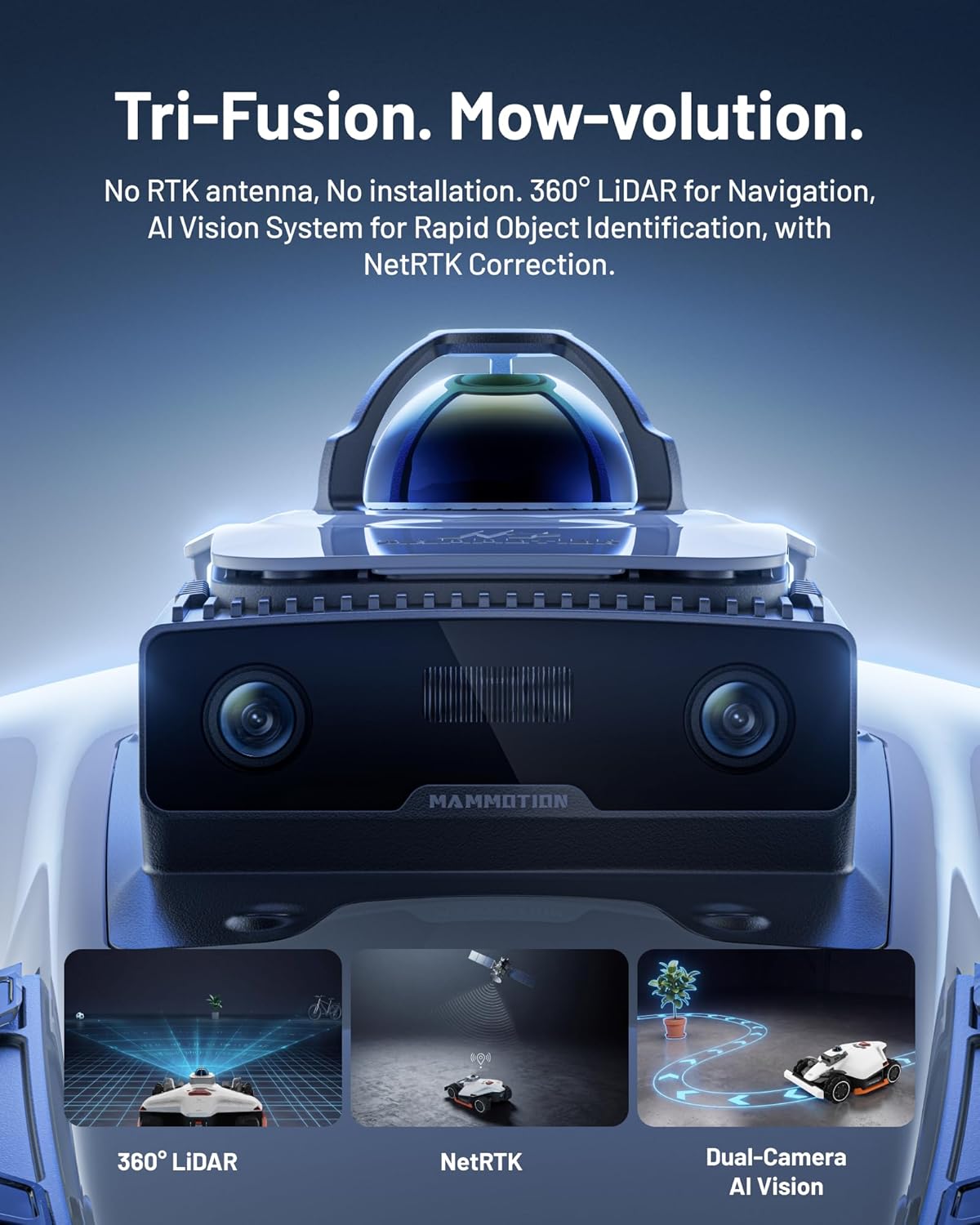
If you’ve been shopping for a robot lawn mower lately, you’ve probably noticed the hottest selling point right now isn’t battery life or cutting width — it’s “no boundary wire required.” Traditional robot mowers (the kind that have been around since the late 1990s) use a thin physical wire buried or pinned around the lawn’s perimeter to tell the robot where to stop. Removing that wire sounds like pure upside: no multi-hour installation, no wire breaks to diagnose, no dead zones near the stakes. But the systems that replace the wire — mainly RTK GPS (a high-precision satellite positioning method accurate to a few centimeters rather than meters) and vision-based obstacle detection (cameras or lidar that identify objects in the mower’s path) — come with their own constraints that the spec sheet presents in the most flattering light possible. This article breaks down what those specs actually mean in practice, where the technology earns its price premium, and how to run the right decision framework before you sign a purchase order or commit a client site.
How Wire-Free Navigation Actually Works (and Where the Marketing Gets Optimistic)
There are three navigation architectures you’ll encounter in the current market, and most spec sheets blur them together.
RTK GPS-only systems — like the Mammotion Luba 2 AWD and the Husqvarna EPOS platform — rely on a fixed base station you install on-site. The base station receives the same satellite signals as the mower and continuously broadcasts correction data, letting the mower calculate its position to roughly 2–3 cm. That sounds impressively tight, and under clear sky conditions it is. The Robot Report’s 2024 coverage of the Mammotion Luba line notes that RTK accuracy holds well in open areas but degrades meaningfully under dense tree canopy, near tall structures, or in the U-shaped backyards surrounded by two-story walls that are incredibly common in newer suburban developments.
Vision + IMU systems use cameras and an inertial measurement unit (a sensor cluster measuring acceleration and rotation) to build a map of the yard and detect obstacles without any satellite dependency. Robotic and Automation News’ 2025 feature on emerging boundary-free platforms notes this architecture handles canopy shade better but struggles with reflective surfaces, wet grass that changes appearance between mapping sessions, and the classic “my golden retriever’s toy looks exactly like a fallen branch” problem.
Hybrid systems — sensor fusion combining RTK GPS with cameras and/or ultrasonic sensors — are where the category is clearly heading. IEEE Spectrum’s 2024 analysis of sensor fusion for outdoor autonomous navigation explains that fusing position data with vision significantly reduces the failure modes of each individual sensor, but it also introduces calibration complexity and, frankly, more software update surface area where things can go sideways.
The practical takeaway: when a spec sheet says “GPS navigation” without specifying RTK, or says “obstacle detection” without specifying the sensor type, you are almost certainly looking at a less capable implementation than the lead feature implies.
The Specs That Actually Predict Real-World Performance
Here are the four numbers you should extract from any wire-free mower spec sheet and what they really mean:
1. RTK Positioning Accuracy: ”≤ 2.5 cm” vs. ”≤ 10 cm”
The difference between 2.5 cm and 10 cm RTK accuracy isn’t just a spec-sheet flex — it determines whether the mower reliably respects a flower bed edge or occasionally clips it. Owners of RTK-accurate systems consistently report clean, repeatable borders after the first mapping run. Owners of systems in the 10 cm bracket report what one long-run review aggregated by The Robot Report describes as “drift creep” — the mow pattern slowly migrating toward an edge over several sessions. If you’re evaluating a system for a landscape maintenance context or a client site with defined hardscape edges, the 2.5 cm class is the minimum defensible spec.
2. Slope Rating: Percent Grade vs. Degrees (and Whether It’s Mowing or Just Traversing)
Most spec sheets list a single slope number. What they often omit is that the mowing slope rating (the grade the machine can cut on) is frequently lower than the traversal slope rating (the grade it can drive across without sliding). A mower rated “35% slope” may be quoting traversal capability, while its practical mowing limit on wet grass is closer to 20–25%. Wired’s 2025 review of autonomous lawn robots specifically flags this distinction as the source of the most common buyer disappointment in sloped residential properties. Ask your dealer or check the technical documentation: does the slope rating apply to mowing or movement?
3. Obstacle Detection Range and Classification
“Detects obstacles” is nearly meaningless without range and classification capability. A system that detects a solid obstacle at 20 cm is reacting; a system that detects and classifies at 60–80 cm is planning. The difference shows up in how the mower recovers — a reactive system bumps, reverses, and rerouts; a planning system smoothly arcs around. For high-obstacle environments (kids’ toys, garden hoses, pet zones), detection range under 40 cm will generate a lot of stuck-mower incidents. Published specs for current-generation systems like the Segway Navimow i Series list ultrasonic detection range explicitly; others bury it or omit it entirely, which is itself a signal.
4. Base Station Line-of-Sight Requirement
Every RTK system requires a base station with a clear view of the sky. What varies is how sensitive that requirement is and how far the mower can roam from the station. Some systems specify a maximum working radius of 100 m from the base; others claim 200 m+. But the real constraint is often signal reliability in multipath environments — areas where the satellite signal bounces off walls before reaching the antenna. IEEE Spectrum’s sensor fusion analysis notes that multipath interference is the dominant cause of unexpected RTK position jumps, not raw signal strength. A base station mounted on a roof peak performs very differently from one mounted on a fence post between two garages.
By the Numbers
| Spec | Entry RTK tier | Premium RTK tier |
|---|---|---|
| Positioning accuracy | 5–10 cm | 1–2.5 cm |
| Max working area | 0.5–1 acre | 1.25–5 acres |
| Slope (mowing, dry) | 20–25% | 30–45% |
| Obstacle detect range | 20–40 cm | 60–100 cm |
| Typical installed cost (unit + base station + setup) | $1,800–$3,500 | $3,500–$7,500+ |
Husqvarna’s EPOS platform, covered by Robotics and Automation News in their 2025 boundary-wire extinction timeline piece, sits firmly in the premium tier and is increasingly the reference system that others benchmark against in this category.
The Hidden Costs the Spec Sheet Definitely Won’t Show You
This is where most buyers get surprised, even experienced ones.
Base station installation labor. RTK systems require a professionally mounted base station with a clear sky view, weatherproof cabling, and in many installs, a dedicated power run. Depending on the site, this can run $300–$800 in labor that isn’t in the product price. For multi-zone properties or commercial accounts, you may need multiple base stations.
Mapping time per property. Wire-free systems require an initial boundary mapping session — driving or walking the perimeter, or running a supervised initial mow — that can take 30–90 minutes per zone. For a landscaping operation managing 20+ accounts, that’s real labor cost. Some systems allow map transfer or cloud-based map storage; others require per-unit mapping with no portability.
Firmware update management. These systems are far more software-dependent than wire-guided predecessors. Owners across aggregated reviews consistently flag that major firmware updates occasionally reset calibration parameters, alter obstacle sensitivity thresholds, or change mowing pattern logic in ways that require re-mapping or re-tuning. Budget time — not just money — for update management, especially in the first 18 months of a platform’s commercial life.
Connectivity dependency. Many wire-free systems require active cellular or Wi-Fi connectivity for full feature access, cloud-based map storage, and remote monitoring. Some features degrade or disable in offline mode. For rural properties with poor connectivity, this is a genuine operational constraint, not a minor footnote.
The Decision Framework: If X, Then Y
You’ve read the specs, you’ve mapped the hidden costs, and you’re still evaluating. Here’s a plain-language decision tree for the most common scenarios:
If your target property is open, flat, under 1 acre, with reliable sky view: Entry-tier RTK (Mammotion Luba, Segway Navimow i Series) at the $1,800–$3,500 installed range is likely the right call. The accuracy is sufficient, and you don’t need to pay for capabilities the site can’t use.
If you’re managing sloped terrain above 25% grade, or a property with dense canopy over more than 30% of the mowing area: Move to a hybrid sensor-fusion system or the Husqvarna EPOS tier. The slope and canopy failure modes of entry RTK are real enough that owners report seasonal reliability problems even on otherwise favorable sites.
If this is a commercial landscaping application with multiple client sites: The per-property mapping cost and base station portability question becomes your primary evaluation criterion — more than raw navigation accuracy. Systems that allow map export, fleet management dashboards, and base station reuse across sites have a materially different total cost of ownership than their sticker prices suggest.
If obstacle density is high (pets, children’s play areas, seasonal garden features): Prioritize obstacle detection range and classification capability over GPS accuracy tier. A less precise mower that reliably stops at 80 cm beats a highly accurate mower that bumps into the sprinkler head every third pass.
If you’re still inside a negotiation or under LOI with a landscaping client who expects wire-free performance: Be specific in your contract language about what “wire-free” includes. Explicitly define base station installation responsibility, mapping labor, firmware update obligations, and performance standards (coverage consistency, edge tolerance) with a testing period before full acceptance. Wired’s 2025 assessment of the category makes the point plainly: the technology works, but buyer expectations set against marketing language — rather than realistic operational specs — are the primary source of disputes in early commercial deployments.
Wire-free robot mowers represent a genuine step forward in autonomous outdoor equipment, and the best current-generation systems earn their price premium on the right sites. But the spec sheet is written to get you interested, not to help you match the product to your conditions. The gap between “RTK GPS-equipped” and “reliably navigates your specific property” is where the real buying decision lives — and now you have the framework to close that gap before you sign anything.